Historic Continental Divide GPS Track (2005)
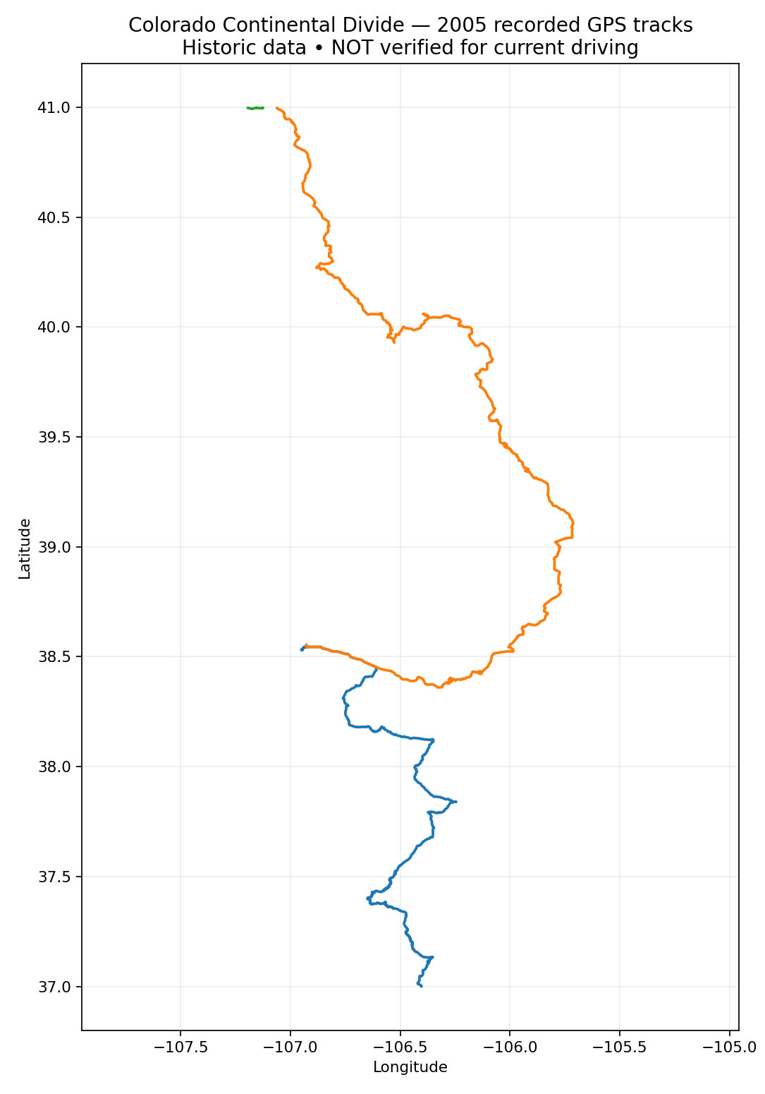
Ron's own 2005 Garmin recording along Colorado's Continental Divide, shown as recorded. This is a historic track, not a current driving route.
Historic track. Not verified for current driving.
This line was recorded in 2005 and has not been checked against current Motor Vehicle Use Maps (MVUM), seasonal or permanent closures, or private property boundaries. Roads, gates, and land status may have changed. Do not navigate from this track alone. Confirm current legal access with the managing agency before you go.
About this recording
This is Ron's own Garmin GPS recording from 2005 along the Continental Divide in Colorado. We are sharing it as a historic record of where the tracks were logged, not as a checked route.
- 3 separate segments, 1,127 recorded points in total.
- Gaps between segments are not connected. We did not draw connector lines or guess what happened between them.
- Google Maps does not recalculate the route. The orange lines are the raw 2005 points.
- We have not published mileage, difficulty, or drive time for this track because it has not been measured or checked for current use.
Recorded track map
Historic Garmin recordings (2005) • 1,127 points • 3 separate segments • NOT VERIFIED FOR CURRENT DRIVING
GPX Download
GPX not yet available. A GPX file will be posted here only after the route is verified.
Free with a one-time sign-up. Sign up once and every GPX on the site unlocks in this browser.
Sign up to unlock GPX downloadsYou're signed up. Your download is ready.
Download GPXHistoric recording (2005). Not verified for current driving. Three segments kept separate.
GPX download
The Download GPX button gives you the original 2005 recording. If you load it into a GPS or app, treat it as historic reference only and pair it with current MVUM maps and agency information.
Track: historic Garmin GPS recording (2005) by Ron Douglas, owned by Overland Journey / Local Business Assist LLC. Status: historic, unverified.
Hero image: recorded track overview generated from the same 2005 track data (owned).
Map display: Google Maps.
Related adventures

Complete overland adventures for the vehicle you actually own. Routes are researched from official sources and reviewed before we publish them.
As an Amazon Associate we earn from qualifying purchases.